What is it for?
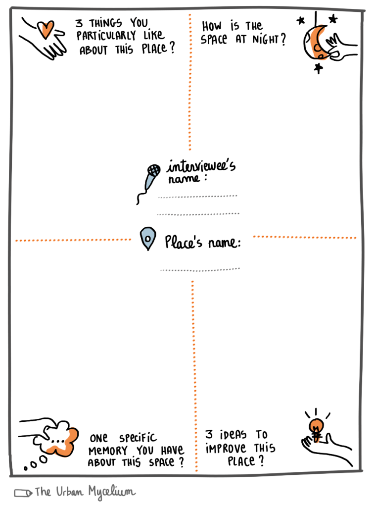
User interviews are individual, in-depth live conversations with a user of a space. Through a set of questions you are guided to understand people’s experience of the space. User interviews are a great way to pin point opportunities and generate ideas.
When can you use it?
User interviews are best conducted during the diagnostic phase, when you evaluate an existing place or building. But they can be conducted throughout the life of the urban project to reevaluate people’s experience.
How to use it?
Reproduce this template on your notebook, or print it in multiple copies. Use one template for one person. Go out in public space and conduct interviews with strollers passing by, entrepreneurs who have their shop or office around the space, etc.
Try to interview a range of users as diverse as possible (you can rely on your stakeholder analysis for that!).
When back home, compare the interviews and draw conclusions: what is common, what is different?
A few things to note:
- Prepare your interview and adapt the questions to your specific situation.
- You don’t have to follow the questions strictly. Be open to where the conversation takes you!
- Keep in mind that user interviews provide valuable insights about a space, but they are meant to be subjective (and reflect a personal experience). For a more comprehensive understanding of a space, take a look at The City at Eye Level form or the Place Game by Project for Public Spaces.
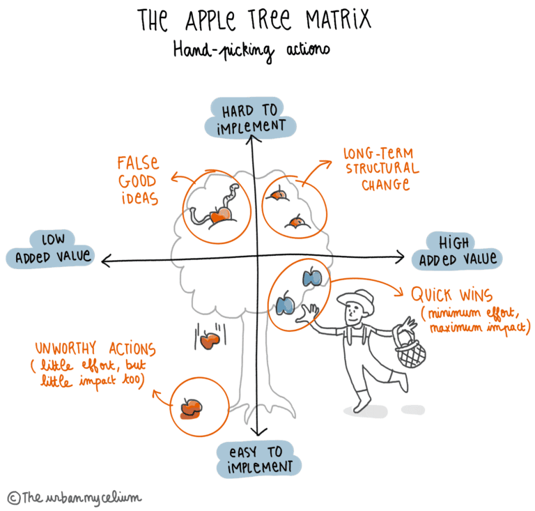
3. The apple tree matrix
What is it for?
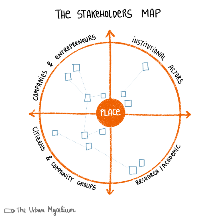
A stakeholder map is a powerful tool used in various contexts. It is very useful in urban planning processes, to map the people and organizations who are involved in the project / place (whether it exists already or is yet to be designed).
Stakeholders are mapped depending on their category (private, public, knowledge institutes, citizens and community groups) and proximity to the project. The more at the centre a stakeholder is, the more influence they have on the project. The stakeholder’s position might change depending on the project / place.
When can you use it?
You can use a stakeholder map at the beginning of a planning process, to identify the strengths and gaps in the network. It will help you determine the direction of future engagement efforts.
How to use it?
Draw this template on a large A1 poster or on a flipchart (alternatively, create an online version, for example on Miro or Mural).
- Identify stakeholders. List the user groups and local associations, the knowledge institutes, private companies and public organizations who are (directly or indirectly) connected to your project or place.
- Categorize stakeholders. Map the stakeholders depending on their level of interest and power. Are they key decision makers and partners in the project? Trust is critical when it comes to efficient collaboration. Are they “champions” or “cheerleaders”, willing to be involved or enthusiastic supporters of your efforts? Or rather challengers, resisting change? Are they actually there at all, or absent in the discussion / marginalized?
You can also draw connections between the different stakeholders, to indicate specific relationships.
- Prioritize stakeholders. Create a plan on how to engage with the stakeholders. You can go and interview the users of the space. You can reach the “challengers”, listen to their concerns and try to heal the relationship. More importantly, you can identify who is poorly represented / not represented at all, and find ways to have them actively involved in the project.
A stakeholder map is a tool you can update throughout the whole planning process!
2. Place-based user interview template